


eBookSecond Edition (Second Edition)
Available on Compatible NOOK devices, the free NOOK App and in My Digital Library.
Related collections and offers
Overview
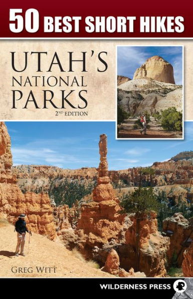
In 50 Best Short Hikes in Utah's National Parks, veteran hiking guide Greg Witt shares the best routes in each park, hikes that are both "must see" and accessible. Park visitors who are short on time will find this book to be the ideal traveling companion, because it quickly helps readers identify the hikes and sights that will make the best use of their time and provide maximum enjoyment.
Each hike in the book includes distances, highlights, area maps, and easy-to-follow trailhead directions to make hike selection fast and efficient. Once on the trail, the detailed maps, route description, and interpretive details insure that hikers get the most out of their trip.
Even avid hikers and experienced desert explorers will find new insights and discoveries as Witt's interesting and approachable style details the geologic forces that created this landscape. He brings to life the human history--prehistoric cliff-dwellers, native tribes, ranchers, farmers, loggers, miners, and outlaws--that adds to the color of the Colorado Plateau where these five parks are set.

Product Details
| ISBN-13: | 9780899977256 |
|---|---|
| Publisher: | Wilderness Press |
| Publication date: | 01/20/2014 |
| Series: | 50 Best Short Hikes |
| Sold by: | Barnes & Noble |
| Format: | eBook |
| Pages: | 256 |
| File size: | 91 MB |
| Note: | This product may take a few minutes to download. |
About the Author
Greg is the founder and Chief Adventure Officer of Alpenwild, the leading operator of hiking and trekking tours in the Swiss Alps. Some weeks, Greg hikes more miles than he drives, which means he wears out his boots faster than he wears out his tires. He has crossed the Grand Canyon on foot many times, climbed Colorado's three highest peaks in three days, and in a recent summer in the Alps he hiked over 700 miles and gained nearly 100,000 vertical feet of elevation--the equivalent of climbing Everest 9 times.
Now he leads readers on the most breathtaking hikes and exciting outdoor adventures on the globe. He comes ready to discuss the geology, history, archaeology, weather patterns, culture, flora, and fauna of the exciting locales he loves. Other titles include 60 Hikes within 60 Miles: Salt Lake City and Ultimate Adventures: A Rough Guide to Adventure Travel. He is the US Editor of Off the Tourist Trail: 1000 Unexpected Travel Alternatives (DK Eyewitness Travel) and a contributing editor of Make the Most of Your Time on Earth, A Rough Guide to the World.
Read an Excerpt
TRAIL NARRATIVE SELECTION
Bryce Canyon National Park: Water Canyon and Mossy Cave
Trailhead Location: A small parking area located on the south side of Utah Highway 12, just 3.7 miles east of its junction with Utah Highway 63
Trail Use: Walking, hiking
Distance & Configuration: 1.0-mile out-and-back including a short spur to Mossy Cave
Elevation Range: 6,840 at the trailhead to 6,950 at Mossy Cave
Facilities: Vault toilets at the trailhead
Highlights: Wet, often ice-filled cave and nearby waterfall
Description
The presence of water in Water Canyon is a tribute to the early settlers who dug a 10-mile irrigation canal by hand in 1892 to bring water from the East Fork Sevier River to the Paria Valley. The canal was successful in sustaining desert farming communities and also created a scenic canyon with a stream—the only stream in Bryce Canyon National Park.
The cave, cooling stream, and waterfall make this a fun short hike, well-suited to hikers of all ages and abilities. The location on Highway 12 in the northern section of the park, just east of the park entrance, makes Water Canyon a convenient place to stop and stretch your legs after several hours in the car and before entering the heart of Bryce Canyon.
Route
From the roadside parking area the wide trail makes a gentle ascent into the canyon amidst hoodoos on the upper slopes casting a glow of orange and white. Although Water Canyon is not a large canyon, it has a sense of openness with a mix of bristlecone and limber pines on the surrounding slopes.
You’ll appreciate the sturdy bridge with the metal railing. The two bridges are fairly recent additions and replace numerous previous bridges which had been washed away during flash floods. It’s hard to imagine that the small stream you’re crossing could swell to a torrent capable of washing out a bridge but it gives you a sense of the potential for flash flooding in a desert canyon.
The stream has a rather inglorious name—Tropic Ditch—but a proud history. It’s just over a hundred years since the stream has been in existence, but the stream has already had a profound effect on the canyon ecosystem. It has attracted wildlife not previously seen in the area. Flora such as the Watson Bog Orchid and the Mountain Death Camas appear in the now-watered canyon, and over time the geology of the canyon will continue to become more like other V-shaped stream-cut canyons.
After crossing the bridge, the trail ascends more steeply and soon arrives at a fork. Take the route to the left leading on to Mossy Cave. Technically more a grotto or alcove than a cave, Mossy Cave invites inspection nonetheless. This shallow, moss-filled alcove fed by an underground spring, so it is adorned with ferns and in winter with icicles.
Now returning down the trail to the fork, take the branch to the right (north) this time and head in the direction of the waterfall. This 15-foot plunge drops into a circular pool exposing dolomite limestone bedrock. The pools are perfect for a refreshing break on a hot summer day.
Along with the hoodoos you can also spot several windows sculpted into the rock above the falls to your right. It’s a short trail leading to the window and makes for a fun add-on with some great views down to the waterfall. Retrace your route down the canyon to return to the trailhead.
Trailhead GPS Coordinates: N37° 39.946’ W112° 6.619
From the junction of Utah Highway 63 and Utah Highway 12 continue east on Highway 12 for 3.7 miles to a small parking area located on the south side of the highway.
SIDEBAR: The Tropic Ditch
In 1874, a few pioneers heard about the Paria Valley from the Native Americans. It sounded appealing, with a favorable climate, abundant grazing, arable land, timber, coal, and water. The pioneers soon settled the communities of Cannonville and Henrieville which lie to the east of Bryce Canyon on the Paria River.
But the growth of these communities forced farmers to look for more reliable water sources than the seasonal flow of the Paria River. They conceived a plan to bring water from the East Fork Sevier River on the Paunsaugunt Plateau to the west of Bryce Canyon to augment the flow of the Paria River.
From 1890 to 1892 Mormon pioneers labored with picks and shovels to carve a 10-mile canal across the Paunsaugunt Plateau. Since that time, except during the drought of 2002, the Tropic Ditch as supplied irrigation water to the Paria Valley. The water rights extend from mid-April to mid-October when you’ll see water pouring over the falls and down the canyon.
Table of Contents
TABLE OF CONTENTS
Dedication
Acknowledgments
The Very Best Short Hikes
Introduction
Using This Book
About the Author
Map Legend
ARCHES NATIONAL PARK
Arches National Park Regional Overview
Hikes 1-9
1. Park Avenue
Sidebar: Biological Soil Crusts
2. Balanced Rock
3. Windows Loop
4. Double Arch Trail
Sidebar: How Do Arches Form?
5. Delicate Arch & Delicate Arch Viewpoint Spur
6. Sand Dune Arch & Broken Arch
Sidebar: Fallen Arches
7. Devil's Garden Arches: Pine Tree, Tunnel, Landscape, Partition, Navajo, and Double O
Sidebar: What Qualifies as an Arch?
8. Tower Arch Trail
Sidebar: Where Are the Leaves on Mormon Tea?
9. Fiery Furnace
BRYCE CANYON NATIONAL PARK
Bryce Canyon National Park Regional Overview
Hikes 10-17
10. Queens Garden & Navaho Loop
Sidebar: How long does a hoodoo last?
11. Bristlecone Loop
Sidebar: Ebenezer Bryce
12. Sunrise to Sunset Rim Trail
Sidebar: What Makes Those Colors?
13. Hat Shop
Sidebar: What Is a Hoodoo?
14. Peekaboo Loop Rim Trail
Sidebar: What Is the Grand Staircase?
15. Fairyland Loop
Sidebar: Pinon Pine
16. Tower Bridge
Sidebar: Is it an Arch or a Bridge?
17. Water Canyon & Mossy Cave
Sidebar: The Tropic ditch
CANYONLANDS NATIONAL PARK
Canyonlands National Park Regional Overview
Hikes 18-30
18. Horseshoe Canyon
Sidebar: Petroglyphs
19. Mesa Arch Loop
Sidebar: John Wesley Powell
20. Neck Spring Loop Trail
Sidebar: Dead Horse Point
21. Murphy Point Trail
22. White Rim Overlook Trail
Sidebar: Juniper
23. Grand View Trail
24. Aztec Butte Trail
25. Whale Rock Trail
26. Crater View Trail
27. Upheaval Dome Overlook
Sidebar: The Confluence
28. Syncline Loop Trail
29. Slickrock Trail
30. Elephant Hill to Chesler Park
CAPITOL REEF NATIONAL PARK
Capitol Reef National Park Regional Overview
Hikes 31-40
31. Hickman Bridge
Sidebar: Cottonwood Trees
32. Cohab Canyon
Sidebar: Desert Varnish
33. Golden Throne Trail
Sidebar: Bats
34. Chimney Rock Loop Trail
Sidebar: How the Black Boulders Got Here
35. Fremont Gorge Viewpoint Trail
Sidebar: John C. Fremont
36. Grand Wash
37. Capitol Gorge Trailhead to the Tanks
Sidebar: Life in the Potholes
38. Rim Overlook at Navajo Knobs Trail
Sidebar: What Is a Monocline?
39. Upper Muley Twist Canyon
40. Sulphur Creek
Sidebar: Why Is it Called Capitol Reef?
ZION NATIONAL PARK
Zion National Park Regional Overview
Hikes 41-50
41. Angles Landing
Sidebar: Building Walter's Wiggles
42. Riverside Walk
Sidebar: Flooding in the Virgin River
43. Weeping Rock & Observation Point
Sidebar: Seeps in Sandstone
44. Hidden Canyon Trail
45. Emerald Pools Trail
46. Canyon Overlook Trail
47. Sand Bench Trail
48. Watchman Trail
Sidebar: Leaving the Car Behind
49. Pa'rus Trail
50. Cable Mountain Trail
Sidebar: Cable Mountain Draw Works
Bonus: Taylor Creek Trail
INDEX