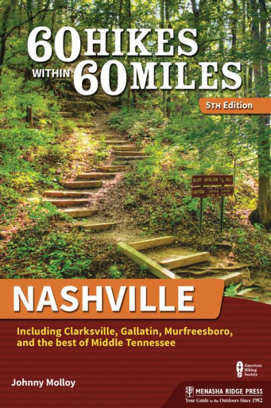
60 Hikes Within 60 Miles: Nashville: Including Clarksville, Gallatin, Murfreesboro, and the Best of Middle Tennessee

60 Hikes Within 60 Miles: Nashville: Including Clarksville, Gallatin, Murfreesboro, and the Best of Middle Tennessee

by Johnny Molloy
60 Hikes Within 60 Miles: Nashville: Including Clarksville, Gallatin, Murfreesboro, and the Best of Middle Tennessee

60 Hikes Within 60 Miles: Nashville: Including Clarksville, Gallatin, Murfreesboro, and the Best of Middle Tennessee

by Johnny Molloy

Paperback(5th Revised ed.)

$22.95 
  • SHIP THIS ITEM
    Qualifies for Free Shipping
  • PICK UP IN STORE
    Check Availability at Nearby Stores

Related collections and offers


Overview

Hike near Nashville, Tennessee, on 60 of the area’s best trails!

The best way to experience Nashville is by hiking it. Get outdoors with veteran Tennessee outdoorsman Johnny Molloy, with the full-color edition of 60 Hikes Within 60 Miles: Nashville. A perfect blend of popular trails and hidden gems, the selected hikes transport you to scenic overlooks, wildlife hot spots, and historical settings that renew your spirit and recharge your body.

Take in the beautiful wildflowers and magnificent wildlife on the Henry Hollow Loop at Beaman Park. Immerse yourself in history along the Gordon House and Ferry Site Walk, just off the Natchez Trace Parkway. Enjoy a hike with the entire family on Old Hickory Lake Nature Trail, part of the Nashville Greenway system. Challenge yourself with climbs and descents along the Bearwaller Gap Hiking Trail, one of the finest paths in middle Tennessee. With Johnny as your guide, you’ll learn about the area and experience nature through 60 spectacular outings!

Each hike description features key at-a-glance information on distance, difficulty, scenery, traffic, hiking time, and more, so you can quickly and easily learn about each trail. Detailed directions, GPS-based trail maps, and elevation profiles help to ensure that you know where you are and where you’re going. Tips on nearby activities further enhance your enjoyment of every outing. Whether you’re a local looking for new places to explore or a visitor to the area, 60 Hikes Within 60 Miles: Nashville provides plenty of options for a couple hours or a full day of adventure, all within about an hour from Nashville and the surrounding communities.


Product Details

ISBN-13: 9781634043403
Publisher: Menasha Ridge Press
Publication date: 01/04/2022
Series: 60 Hikes Within 60 Miles
Edition description: 5th Revised ed.
Pages: 296
Sales rank: 307,796
Product dimensions: 8.90(w) x 6.00(h) x 0.70(d)

About the Author

Johnny Molloy is a writer and adventurer based in Johnson City, Tennessee. His outdoor passion was ignited on a backpacking trip in Great Smoky Mountains National Park while he was attending the University of Tennessee. That first foray unleashed a love of the outdoors that led Johnny to spend over 4,500 nights backpacking, canoe camping, and tent camping over the past three decades. Friends enjoyed his outdoor adventure stories; one even suggested he write a book. He pursued his friend’s idea and soon parlayed his love of the outdoors into an occupation. The results of his efforts are over 75 books and guides. His writings include hiking guidebooks, camping guidebooks, paddling guidebooks, comprehensive guidebooks about a specific area, and books about true outdoor adventures throughout the eastern United States. Though primarily involved with book publications, Johnny writes for varied magazines and websites. He continues writing and traveling extensively throughout the United States, pursuing a variety of outdoor endeavors. Johnny is a Gideon and an active member of the First Presbyterian Church in Johnson City. His non-outdoor interests include reading, ancient and American history, and University of Tennessee sports.

Read an Excerpt

Old Hickory Lake Nature Trail

  • Distance and Configuration: 1.5-mile triple loop
  • Difficulty: Easy
  • Scenery: Pine and hardwood forest, willow swamp, pond
  • Exposure: Nearly all shady
  • Traffic: Some
  • Trail Surface: Asphalt, pine needles, boardwalks
  • Hiking Time: 1 hour
  • Access: No fees or permits required
  • Maps: USGS Goodlettsville; at trailhead
  • Pets: On leash only
  • Facilities: Restrooms at nearby swim beach
  • Contact: 615-736-7161; www.lrn.usace.army.mil/Locations/Lakes/Old HickoryLake/Recreation/Trails.aspx
  • Location: Old Hickory

In Brief

This easy walk, suitable for young children, uses a combination of three miniloops to explore the woods near Old Hickory Lake Dam. The loops traverse pine woods and go over boardwalks, culminating in a trip to a pond with a viewing platform.

Description

This trail is actually part of the Nashville Greenway system, though only a portion of the path is paved. The U.S. Army Corps of Engineers built it in the mid-1970s. The mounds you see in the area are part of the dredging material left from the erection of nearby Old Hickory Dam, which was finished in 1954. The forest has reclaimed the area, with the help of some loblolly pines planted in the 1960s.

The loblolly pine is not native to Middle Tennessee (it grows in a belt from east Texas to Florida and north to eastern Virginia) and is among the fastest-growing Southern pines. The pine’s rapid growth makes it popular for planting and cultivation for pulpwood and lumber. Even by pine standards, the loblolly has especially fragrant needles.

The manner in which nature repairs itself is called plant succession. For example, an area is cleared and then covered with fill. Later, plants that thrive in the sun, such as blackberries, begin to grow. These species provide shade for young plants and trees that can’t tolerate open sun. The trees then grow and ultimately return the forest to its former state.

Leave the parking area and soon enter Woodland Loop. Circle through loblolly pines, passing beneath a power line. A viewing blind is to your left. Quietly head over to the fence and peer through the boards, where a deer or squirrel may be stirring. Reach a long boardwalk that winds over a wetland. To protect them from drainage and development, wetlands have come under increasing protection over the years. Wetlands are natural filters for water as it seeps into the earth and also foster wildlife and insects, especially mosquitoes.

Leave the Woodland Loop at 0.4 mile, near the main paved path. Return to the woods, now on the Willow Swamp Loop. Soon reach another boardwalk. Willow trees thrive where drainage is poor, claiming their special niche in the web of life. Sycamore trees also grow along the wetter margins. In summer, the swamp emits the pungent odor of decay.

Return to the paved part of the trail, but soon turn away on the Wildlife Loop. This trail curves beneath the tall pines—notice the blackened trunks of trees here. Low-level, low-intensity forest fires often sweep through pine woods. To thrive and ultimately survive, a pine forest needs periodic fire. Some species of pine, such as Florida’s sand pine, need fire to open their cones.

Soon you’ll emerge at a pond, where a little viewing platform allows you to peer into the water. Life at the pond varies season to season. During winter, a time of hibernation, frogs and turtles lie buried in the soil beneath the pond, and toads, snakes, and salamanders will be under old stumps and logs. Spring, though, is much more alive. Birds are singing. Ducks may be swimming. Turtles are out, enjoying the sun atop old logs. In summer, the pond may be abuzz with dragonflies chasing mosquitoes. If you come here in the evening, crickets by the thousands will be humming in harmony, and lightning bugs will be flickering off and on. Fall is when the pond will be at its lowest. Decaying leaves will be floating on the surface, later to enhance the nutrients of the pond. And marsh plants around the pond move in as the water shallows.

Follow the paved path from the viewing platform to the main paved Nature Corridor. If you go to the right, the trail soon dead-ends, but you can circle the pond on an informal path. To the left, the paved trail leads through the woods past more wetlands. Enjoy this last relaxing stroll before reaching the trailhead.

Nearby Activities

Old Hickory Beach is open in the warm season, is a year-round boat launch, and has picnic areas and a playground. For more information, call 615-822-4846.

GPS Trailhead Coordinates: N36° 17.708' W86° 39.413'

From Exit 92 on I-65, north of downtown Nashville, take TN 45 4 miles east to Robinson Road, which is just after the bridge crossing the Cumberland River. Turn left on Bridgeway Avenue and follow it 0.5 mile to Swinging Bridge Road. Turn left on Swing- ing Bridge Road and follow it 1.2 miles to Cinder Road. Turn right on Cinder Road and follow it 0.8 mile to reach Old Hickory Lake. Turn left at the sign for Old Hickory Lake Nature Trail, which will be on your left at 0.4 mile.

Table of Contents

Overview Map opposite page

Map Legend vii

Acknowledgments viii

Foreword ix

Preface x

60 Hikes by Category xiii

Introduction 1

Nashville 17

1 Bells Bend Loop 18

2 Burch Reserve 22

3 Bryant Grove Trail 26

4 Couchville Lake Trail 30

5 Ganier Ridge Loop 34

6 Harpeth Woods Trail 38

7 Jones Mill Trail 42

8 MetroCenter Levee Greenway 46

9 Mill Creek Greenway 49

10 Mossy Ridge Trail 52

11 Old Hickory Lake Nature Trail 56

12 Peeler Park Hike 60

13 Richland Creek Greenway: McCabe Loop 64

14 Shelby Bottoms Natural Area: East Loop 68

15 Shelby Bottoms Natural Area: West Loop 72

16 South Radnor Lake Loop 76

17 Stones River Greenway of Nashville 80

18 Volunteer-Day Loop 84

19 Warner Woods Trail 88

WEST (Including Ashland City, Clarksville, and Dickson) 93

20 Confederate Earthworks Walk 94

21 Cumberland River Bicentennial Trail 98

22 Dunbar Cave State Park Loop 102

23 Fort Donelson Battlefield Loop 106

24 Henry Hollow Loop 110

25 Hidden Lake Double Loop 114

26 Laurel Woods Trail 118

27 Montgomery Bell Northeast Loop 122

28 Montgomery Bell Southwest Loop 126

29 Narrows of Harpeth Hike 131

SOUTHWEST (Including Columbia, Fairview, and Franklin) 137

30 Devil's Backbone Loop 138

31 Gordon House and Ferry Site Walk 142

32 Jackson Falls and Baker Bluff 146

33 Lakes of Bowie Loop 150

34 Meriwether Lewis Loop 154

35 Old Trace-Garrison Creek Loop 158

36 Perimeter Trail 162

37 Stillhouse Hollow 166

38 Timberland Park 170

SOUTHEAST (Including Brentwood, Murfreesboro, and Smyrna) 175

39 Adeline Wilhoite River Trail 176

40 Barfield Crescent Park 180

41 Cheeks Bend Bluff View Trail 184

42 Flat Rock Cedar Glades and Barrens Hike 188

43 Hickory Ridge Trail 192

44 Old Stone Fort Loop 196

45 Short Springs State Natural Area Hike 200

46 Smith Park Hike 204

47 Spring Creek Trail 208

48 Stones River Greenway of Murfreesboro 212

49 Stones River National Battlefield Loop 216

EAST (Including Gallatin, Hendersonville, Lebanon, and Mount Juliet) 221

50 Bearwaller Gap Hiking Trail 222

51 Bledsoe Creek State Park Loop 226

52 Cedar Forest Trail 230

53 Collins River Nature Trail 234

54 Drakes Creek Greenway 238

55 Edgar Evins State Park Hike 242

56 Hidden Springs Trail 246

57 Sellars Farm State Archaeological Area 250

58 Upstream and Downstream Trails 254

59 Vesta Glade Trail 258

60 Winding Stairs Hike 262

Appendix A Outdoors Shops 266

Appendix B Places to Buy Maps 266

Appendix C Hiking Clubs 266

Index 267

About the Author 276

From the B&N Reads Blog

Customer Reviews