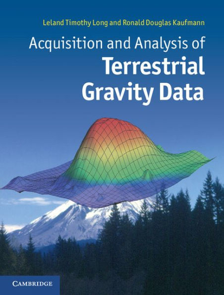
Acquisition and Analysis of Terrestrial Gravity Data
Gravity surveys have a huge range of applications, indicating density variations in the subsurface and identifying man-made structures, local changes of rock type or even deep-seated structures at the crust/mantle boundary. This important one-stop book combines an introductory manual of practical procedures with a full explanation of analysis techniques, enabling students, geophysicists, geologists and engineers to understand the methodology, applications and limitations of a gravity survey. Filled with examples from a wide variety of acquisition problems, the book instructs students in avoiding common mistakes and misconceptions. It explores the increasing near-surface geophysical applications being opened up by improvements in instrumentation and provides more advance-level material as a useful introduction to potential theory. This is a key text for graduate students of geophysics and for professionals using gravity surveys, from civil engineers and archaeologists to oil and mineral prospectors and geophysicists seeking to learn more about the Earth's deep interior.
1112410030
Acquisition and Analysis of Terrestrial Gravity Data
Gravity surveys have a huge range of applications, indicating density variations in the subsurface and identifying man-made structures, local changes of rock type or even deep-seated structures at the crust/mantle boundary. This important one-stop book combines an introductory manual of practical procedures with a full explanation of analysis techniques, enabling students, geophysicists, geologists and engineers to understand the methodology, applications and limitations of a gravity survey. Filled with examples from a wide variety of acquisition problems, the book instructs students in avoiding common mistakes and misconceptions. It explores the increasing near-surface geophysical applications being opened up by improvements in instrumentation and provides more advance-level material as a useful introduction to potential theory. This is a key text for graduate students of geophysics and for professionals using gravity surveys, from civil engineers and archaeologists to oil and mineral prospectors and geophysicists seeking to learn more about the Earth's deep interior.
54.99 In Stock
Acquisition and Analysis of Terrestrial Gravity Data

Acquisition and Analysis of Terrestrial Gravity Data

Acquisition and Analysis of Terrestrial Gravity Data

Acquisition and Analysis of Terrestrial Gravity Data

eBook

$54.99  $72.99 Save 25% Current price is $54.99, Original price is $72.99. You Save 25%.

Available on Compatible NOOK devices, the free NOOK App and in My Digital Library.
WANT A NOOK?  Explore Now

Related collections and offers

LEND ME® See Details

Overview

Gravity surveys have a huge range of applications, indicating density variations in the subsurface and identifying man-made structures, local changes of rock type or even deep-seated structures at the crust/mantle boundary. This important one-stop book combines an introductory manual of practical procedures with a full explanation of analysis techniques, enabling students, geophysicists, geologists and engineers to understand the methodology, applications and limitations of a gravity survey. Filled with examples from a wide variety of acquisition problems, the book instructs students in avoiding common mistakes and misconceptions. It explores the increasing near-surface geophysical applications being opened up by improvements in instrumentation and provides more advance-level material as a useful introduction to potential theory. This is a key text for graduate students of geophysics and for professionals using gravity surveys, from civil engineers and archaeologists to oil and mineral prospectors and geophysicists seeking to learn more about the Earth's deep interior.

Product Details

ISBN-13: 9781139610698
Publisher: Cambridge University Press
Publication date: 01/17/2013
Sold by: Barnes & Noble
Format: eBook
File size: 14 MB
Note: This product may take a few minutes to download.

About the Author

Leland Timothy Long is Emeritus Professor of Geophysics at Georgia Institute of Technology, where he has taught geophysics for over 40 years, on topics including exploration geophysics, potential theory, seismology, data analysis and earth science. He is also a licensed Professional Geologist in Georgia and consults on topics of gravity data interpretation, seismic hazard and blast vibration. Professor Long's research interests in potential methods include the interpretation of regional crustal structures for seismic hazards, deflections of the vertical, statistical properties of gravity field, and microgravity for the detection of sink holes, and his research interests in seismology have emphasized seismicity, seismic networks, induced seismology, many aspects of theoretical seismology related to scattering and scattering inversion, and near-surface surface wave analysis. In 2006, Professor Long was awarded the Jesuit Seismological Association Award honouring outstanding contributions to observational seismology.
Ronald Douglas Kaufmann founded Spotlight Geophysical Services in 2009 and has over 20 years of geophysical consulting experience, including positions of Vice President and Senior Geophysicist at Technos, Inc. and postgraduate experience at Oak Ridge National Laboratory. He holds an MS degree in geophysics from Georgia Institute of Technology and is a licensed professional geophysicist in the State of California. He has led geophysical investigations of the Panama Canal expansion, nuclear power plants, Superfund sites, and other high-profile projects within the United States and abroad. Mr Kaufmann is an expert in the use of microgravity for karst investigations and has been instrumental in the development of geophysical methods in shallow marine environments. He is author and co-author of over thirty professional papers that focus on the application of geophysical techniques. He is a Board member of the Environmental and Engineering Geophysical Society (EEGS) and a Section officer for the Association of Environmental and Engineering Geologists (AEG).

Table of Contents

Preface; 1. Gravitational attraction; 2. Instruments and data reduction; 3. Field acquisition of gravity data; 4. Graphical representation of the anomalous field; 5. Manipulation of the gravity field; 6. Interpretation of density structure; 7. The inversion of gravity data; 8. Experimental isostasy; Appendix A. Common definitions and equations in potential theory; Appendix B. Glossary of symbols; References; Index.
From the B&N Reads Blog

Customer Reviews