
Sonoma County is 35 miles north of San Francisco on the Pacific coast. This California county is known for its wineries and a magnificent natural landscape--a picturesque mix of rugged coastline, steep cliffs, forested hillsides, and verdant agricultural valleys. The cities, towns, and villages are as diverse as the geography. Interspersed throughout the landscape are thousands of acres of undeveloped parklands, forests, and open space.
Day Hikes Around Sonoma County is a collection of 125 of the county's best day hikes, providing access to both well-known and out-of-the-way greenspace. Hikes are found along the Pacific Ocean, across the coastal ridges, into wide valleys, and through thick forests. A third of the hikes are located along the coastline, accessed by Highway 1, which connects the coastal towns as it snakes along the oceanfront cliffs and bluffs. Many coastal access points that are not easily recognized from Highway 1 are clearly described. The remaining hikes explore the inland mountains, hillsides, and valleys through numerous state parks, regional parks, and undeveloped land. Highlights include fog-shrouded redwood forests, creekside canyons, wildlife sanctuaries, lakes, tidal bays, wave-pounded coastline, and sweeping panoramic views. A wide range of hikes accommodates amateur to avid hikers, from beachfront strolls to canyon treks. Straight-forward directions and clear maps accompany all hikes. A thorough index includes cities, trails, and points of interest.
"1122639336"
Day Hikes Around Sonoma County is a collection of 125 of the county's best day hikes, providing access to both well-known and out-of-the-way greenspace. Hikes are found along the Pacific Ocean, across the coastal ridges, into wide valleys, and through thick forests. A third of the hikes are located along the coastline, accessed by Highway 1, which connects the coastal towns as it snakes along the oceanfront cliffs and bluffs. Many coastal access points that are not easily recognized from Highway 1 are clearly described. The remaining hikes explore the inland mountains, hillsides, and valleys through numerous state parks, regional parks, and undeveloped land. Highlights include fog-shrouded redwood forests, creekside canyons, wildlife sanctuaries, lakes, tidal bays, wave-pounded coastline, and sweeping panoramic views. A wide range of hikes accommodates amateur to avid hikers, from beachfront strolls to canyon treks. Straight-forward directions and clear maps accompany all hikes. A thorough index includes cities, trails, and points of interest.
Day Hikes Around Sonoma County: 125 Great Hikes
Sonoma County is 35 miles north of San Francisco on the Pacific coast. This California county is known for its wineries and a magnificent natural landscape--a picturesque mix of rugged coastline, steep cliffs, forested hillsides, and verdant agricultural valleys. The cities, towns, and villages are as diverse as the geography. Interspersed throughout the landscape are thousands of acres of undeveloped parklands, forests, and open space.
Day Hikes Around Sonoma County is a collection of 125 of the county's best day hikes, providing access to both well-known and out-of-the-way greenspace. Hikes are found along the Pacific Ocean, across the coastal ridges, into wide valleys, and through thick forests. A third of the hikes are located along the coastline, accessed by Highway 1, which connects the coastal towns as it snakes along the oceanfront cliffs and bluffs. Many coastal access points that are not easily recognized from Highway 1 are clearly described. The remaining hikes explore the inland mountains, hillsides, and valleys through numerous state parks, regional parks, and undeveloped land. Highlights include fog-shrouded redwood forests, creekside canyons, wildlife sanctuaries, lakes, tidal bays, wave-pounded coastline, and sweeping panoramic views. A wide range of hikes accommodates amateur to avid hikers, from beachfront strolls to canyon treks. Straight-forward directions and clear maps accompany all hikes. A thorough index includes cities, trails, and points of interest.
Day Hikes Around Sonoma County is a collection of 125 of the county's best day hikes, providing access to both well-known and out-of-the-way greenspace. Hikes are found along the Pacific Ocean, across the coastal ridges, into wide valleys, and through thick forests. A third of the hikes are located along the coastline, accessed by Highway 1, which connects the coastal towns as it snakes along the oceanfront cliffs and bluffs. Many coastal access points that are not easily recognized from Highway 1 are clearly described. The remaining hikes explore the inland mountains, hillsides, and valleys through numerous state parks, regional parks, and undeveloped land. Highlights include fog-shrouded redwood forests, creekside canyons, wildlife sanctuaries, lakes, tidal bays, wave-pounded coastline, and sweeping panoramic views. A wide range of hikes accommodates amateur to avid hikers, from beachfront strolls to canyon treks. Straight-forward directions and clear maps accompany all hikes. A thorough index includes cities, trails, and points of interest.
14.99
In Stock
5
1

Day Hikes Around Sonoma County: 125 Great Hikes
448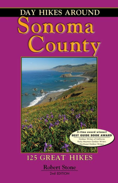
Day Hikes Around Sonoma County: 125 Great Hikes
448eBook (Second Edition)
$14.99
$19.99
Save 25%
Current price is $14.99, Original price is $19.99. You Save 25%.
Related collections and offers
14.99
In Stock

Product Details
| ISBN-13: | 9781573424004 |
|---|---|
| Publisher: | Day Hike Books, Inc. |
| Publication date: | 03/01/2016 |
| Sold by: | Barnes & Noble |
| Format: | eBook |
| Pages: | 448 |
| File size: | 29 MB |
| Note: | This product may take a few minutes to download. |
About the Author
From the B&N Reads Blog