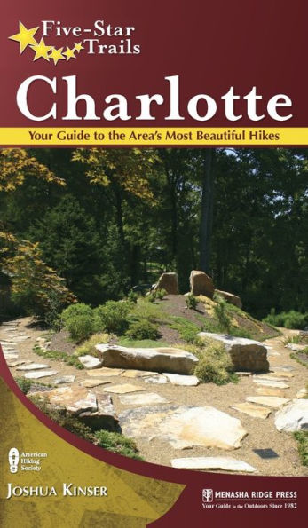
Five-Star Trails: Charlotte: Your Guide to the Area's Most Beautiful Hikes
Five-Star Trails: Charlotte is a handy guide for area residents, vacationers seeking outdoor fun, and for business travelers with a free afternoon. With a diverse collection of hiking routes, the book offers choices for everyone from solo trekkers to companions to families with either youngsters or oldsters to consider.

Researched, experienced, and written by a local author, the guide provides in-depth trail descriptions, directions, and commentary on what to expect along the way. Each hike features an individual trail map, elevation profile, and at-a-glance key info, helping readers quickly determine the perfect trip for them when they are ready to head out the door.

Sized to fit in a pocket, the book is convenient to keep in the car or toss into a backpack. Driving directions direct hikers to the nearest trailhead parking areas, and GPS trailhead coordinates get them to the start of the trail.
"1110833269"
Five-Star Trails: Charlotte: Your Guide to the Area's Most Beautiful Hikes
Five-Star Trails: Charlotte is a handy guide for area residents, vacationers seeking outdoor fun, and for business travelers with a free afternoon. With a diverse collection of hiking routes, the book offers choices for everyone from solo trekkers to companions to families with either youngsters or oldsters to consider.

Researched, experienced, and written by a local author, the guide provides in-depth trail descriptions, directions, and commentary on what to expect along the way. Each hike features an individual trail map, elevation profile, and at-a-glance key info, helping readers quickly determine the perfect trip for them when they are ready to head out the door.

Sized to fit in a pocket, the book is convenient to keep in the car or toss into a backpack. Driving directions direct hikers to the nearest trailhead parking areas, and GPS trailhead coordinates get them to the start of the trail.
32.95 In Stock
Five-Star Trails: Charlotte: Your Guide to the Area's Most Beautiful Hikes

Five-Star Trails: Charlotte: Your Guide to the Area's Most Beautiful Hikes

by Joshua Kinser
Five-Star Trails: Charlotte: Your Guide to the Area's Most Beautiful Hikes

Five-Star Trails: Charlotte: Your Guide to the Area's Most Beautiful Hikes

by Joshua Kinser

Hardcover

$32.95 
  • SHIP THIS ITEM
    Qualifies for Free Shipping
  • PICK UP IN STORE
    Check Availability at Nearby Stores

Related collections and offers


Overview

Five-Star Trails: Charlotte is a handy guide for area residents, vacationers seeking outdoor fun, and for business travelers with a free afternoon. With a diverse collection of hiking routes, the book offers choices for everyone from solo trekkers to companions to families with either youngsters or oldsters to consider.

Researched, experienced, and written by a local author, the guide provides in-depth trail descriptions, directions, and commentary on what to expect along the way. Each hike features an individual trail map, elevation profile, and at-a-glance key info, helping readers quickly determine the perfect trip for them when they are ready to head out the door.

Sized to fit in a pocket, the book is convenient to keep in the car or toss into a backpack. Driving directions direct hikers to the nearest trailhead parking areas, and GPS trailhead coordinates get them to the start of the trail.

Product Details

ISBN-13: 9781634042680
Publisher: Menasha Ridge Press
Publication date: 07/01/2018
Series: Five-Star Trails
Pages: 240
Product dimensions: 5.00(w) x 8.00(h) x (d)

About the Author

Joshua Kinser is a writer and musician based in Chimney Rock, North Carolina, about a 45-minute drive from Charlotte. Growing up by the beaches of Pensacola, Florida, Kinser would head up to the mountains of North Carolina every summer and cater to his passion for hiking and backpacking. Feeding into his love of travel and hunger for new experiences, those early past-times led him to make a profession of writing travel guides, magazine articles, and outdoor-adventure guidebooks.

With regular stints as a wildlife biology field technician for the U.S. Forest Service, Kinser also finds himself these days in back country in Florida, in Hawaii Volcanoes National Park, in Montana's Glacier National Park, and in California's National Forest lands surrounding Yosemite National Park. Indulging his cultural side, Kinser also is a professional drummer performing in wedding bands, clubs, and in cruise ship orchestras. Aboard the latter, he has drummed his way along the perimeters of Australia, Japan, China, New Zealand, Borneo, and South Korea.

As an accomplished author, Kinser wrote Moon Handbook's 2011 guidebook FLORIDA GULF COAST, third Edition. In 2010 alone, he published more than 200 articles online for websites such as Trails.com, Ehow, and USA Today Travel. Completing his degree in Journalism from Pensacola State College in December 2010, he also has worked as a staff writer for Gannet with the PENSACOLA NEWS JOURNAL.

Read an Excerpt

Historic Fourth Ward
Scenery:
5 stars
Trail Condition: 5 stars
Children: 3 stars
Difficulty: 2 stars
Solitude: 1 star

GPS TRAILHEAD COORDINATES: West Fifth and North Tryon streets: N35° 13.693 ' W80° 50.510 '
DISTANCE & CONFIGURATION: 2.6-mile figure eight
HIKING TIME: 3 hours
HIGHLIGHTS: Historic homes, Uptown Charlotte, Old Settlers’ Cemetery, Fourth Ward Park, and Booth Gardens
ELEVATION: 752' at the trailhead to 718' at lowest point
ACCESS: 24/7 but not recommended after dark due to crime and poor lighting in some areas
MAPS: At Charlotte Visitor Info Center or charlottesgotalot.com (click on “Maps”)
FACILITIES: Water fountains at Fourth Ward Park
WHEELCHAIR ACCESS: Yes, but navigation may be difficult on some sidewalks.
COMMENTS: Avoid morning and evening rush hours; this route passes through a congested area of Uptown and will require crossing many roads with frequent traffic.
CONTACTS: Friends of Fourth Ward: fofw.org

Overview

This walk explores the historic heart of Charlotte’s Uptown city center. In the 1800s, four political divisions made up the city’s geographic footprint, and the prosperous neighborhood in the northwest section of the city became the Fourth Ward. Over time, the neighborhood fell into disrepair and remained that way until a newly minted 1970s neighborhood association sought to restore the area’s homes and business properties. Today, this district embraces some of the city’s finest examples of residential architecture by any standards, and on this route you will travel among the Fourth Ward’s best blocks of homes, parks, and attractions. Consider making this walk during the holiday season, when many of the historic homes are open to the public for touring, or in the spring and fall when the weather is most pleasant.

Route Details

The route begins on the corner of West Fifth and North Tryon streets. You will be near the Blumenthal Performing Arts Center, and you can’t miss seeing The Capital Grille. Most locals can direct you toward that business district fine-dining restaurant, should you need reassurance that you’re moving in the right direction to the starting point.

The only public water fountains along this route are in Fourth Ward Park, so you may want to stop in at one of the area’s shops and pick up a snack or drink before you stride into the residential district that lies beyond.

From the West Fifth–North Tryon intersection, head northwest on Fifth Street, passing Qboda Mexican Grill on your left. Walk one block to North Church Street, with Basil Thai restaurant on the right and Molly MacPherson’s Scottish Pub & Grill on your left. On the northwest corner of Church and Fifth, you will see the Old Settlers’ Cemetery, bordered by a waist-high stone wall. Cross Church Street and walk up the six stone steps on the cemetery’s Fifth Street side that lead to the clay-brick path and the entrance to Settlers’. On the opposite side of Fifth Street, you’ll see the First Presbyterian Church, built in 1857. The Victorian Gothic–style church has a noteworthy Tiffany window on the third floor, Church Street side.

Turning your attention back to the cemetery, follow the clay-brick path and walk the length of Charlotte’s oldest cemetery along Fifth Street. The first grave here is dated 1776. At the end of the Fifth Street boundary, turn right (northeast) to continue on the clay-brick path toward the redbrick apartment buildings straight ahead. Exit the cemetery onto Poplar Street, and walk less than a block toward Fourth Ward Park’s entrance at the corner of North Poplar and West Sixth streets. Cross Sixth Street straight ahead (northeast) and then turn left (northwest), crossing Poplar Street. Walk past the circular fountain that defines the entrance to Fourth Ward Park, and follow the redbrick-paved path through the center of the park. Mostly modern apartment and condo developments surround the park; along the path you pass several benches, water fountains, and a playground, and you will come to the nicely landscaped Booth Gardens. Continue on to the Eighth Street exit of the park and turn left (northwest) toward the park’s Pine Street boundary.

Here you enter the core of the Fourth Ward residential district and its streets lined with quintessential Victorian and Southern architectural–style homes. Many of them are truly magnificent. Follow along Eighth Street and then turn right (northeast) onto North Pine Street, where a fountain bubbles in the courtyard to your left and a hard-to-miss, very large, and very pink house stands on the corner to your right. Follow the brick sidewalk along Pine toward West Ninth Street. At the end of the block on your left is the highly recommended Alexander Michael’s Restaurant, serving a variety of tasty and reasonably priced dishes from a pretty international menu. This is a great spot to stop for lunch. They also have a nice selection of beers and microbrews and an appreciable wine list.

Cross West Ninth Street and continue on North Pine, around the curve where Pine turns into Settlers Lane and is lined with newer upscale apartments and town homes. You will come to North Poplar Street, where you turn right (southwest) and follow Poplar down to West Seventh Street. From this perspective, you can enjoy great views of the Uptown buildings rising behind the beautifully restored historic homes that line this street.

Cross West Seventh Street and continue southwest on North Poplar toward West Sixth Street. Turn left (southeast) on West Sixth Street, walking one block southeast toward Church Street and then another block southeast toward North Tryon Street. Once you reach North Tryon, turn right (southwest) and continue on to the corner of West Fifth and North Tryon. You’ve come back to the beginning of your walk, in front of The Capital Grille.

Nearby Attractions

The Fourth Ward is an easy walk to everything in Charlotte’s city center, a busy business and tourism district. An exceptional number of attractions, restaurants, and hotels beckon locals and visitors alike. The Bank of America Stadium is about 0.25 mile southwest of the Fourth Ward. Some notable hotels in the area are the Omni, Marriott, Aloft, Hilton Garden Inn, and the historic Dunhill. Aside from Alexander Michael’s, which you saw at the corner of North Pine and West Ninth streets, other notable restaurants in the area are Mert’s Heart and Soul and the Dandelion Market.

Directions

This route is almost smack-dab in the center of Uptown Charlotte, which begins at the intersection of North and South Tryon streets and East and West Trade streets. (South of this intersection is Downtown Charlotte.) From I-77 North, take Exit 10 to West Trade Street and turn right (east) onto West Trade Street. From I-77 South, take Exit 10B to West Trade Street and turn right (east) onto West Trade Street.

Table of Contents

Overview Map
Overview Map Key
Dedication
Acknowledgments
Preface
Recommended Hikes
Introduction

Center City

1. Downtown-Uptown Walk
2. Historic Fourth Ward
3. Irwin Creek and Stewart Creek Greenway
4. Little Sugar Creek Greenway

North of Charlotte
5. Jetton Park: Loop 1
6. Jetton Park: Loop 2
7. Latta Plantation: Piedmont Prairie Trail & Mountain Island Lake Loop
8. South Mountains State Park: High Shoal Falls Trail
9. South Mountains State Park: River Trail
10. Torrence Creek Greenway East
11. UniversityResearch Park Trail

East of Charlotte
12. Morrow Mountain State Park: Fall Mountain Trail
13. Morrow Mountain State Park: Sugarloaf Mountain Trail
14. Reed Gold Mine
15. Reedy Creek Nature Preserve: Dragonfly Pond Loop
16. University of North Carolina at Charlotte Botanical Gardens
17. Uwharrie National Forest: Badin Lake Trail
18. Uwharrie National Forest: Birkhead Mountains Wilderness Trail

South of Charlotte
19. Cane Creek Park: Northern Red Loop Trail
20. Cane Creek Park: Southern Trails
21. McAlpine Creek Greenway Loop
22. McAlpine Creek Park: Pond Loop
23. McDowell Nature Preserve: Trail Combo 1
24. McDowell Nature Preserve: Trail Combo 2

West of Charlotte
25. Crowders Mountain State Park: Lake Loop
26. Crowders Mountain State Park: Trail Combo
27. Daniel Stowe Botanical Garden
28. Kings Mountain National Military Park: Battlefield Trail
29. Kings Mountain State Park: Historic Farm Trail
30. Kings Mountain State Park: Trail Combo
31. U.S. National Whitewater Center: Lake Loop
32. U.S. National Whitewater Center: North Main Trail

Appendixes & Index
Appendix A: Outdoor Retailers
Appendix B: Hiking Clubs
Index
About the Author
Map Legend
From the B&N Reads Blog

Customer Reviews