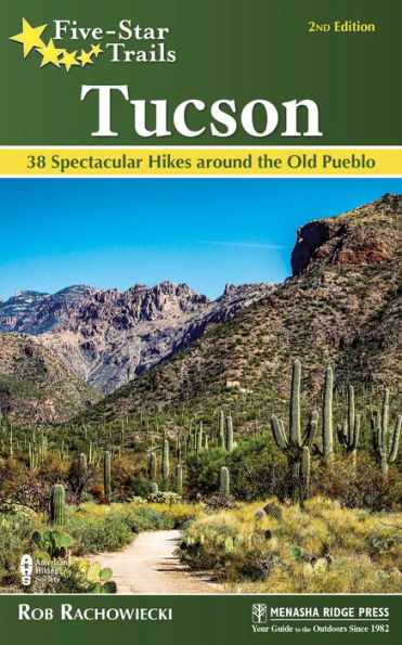
Read an Excerpt
Saguaro National Park East: Freeman Homestead Trail
Scenery: 4, Trail Condition: 4, Children: 4, Difficulty: 1, Solitude: 3
- GPS Trailhead Coordinates: N32° 09.916’ W110° 43.561’
- Distance and Configuration: 1.1-mile balloon
- Hiking Time: 1 hour
- Highlights: Exploratory nature and history trail; saguaros galore
- Elevation: 3,105’ at trailhead, 2,919’ at low point
- Access: Open 7 a.m.–sunset. Admission: $20/$15/$10 per car/motorcycle/ bicycle, pedestrian, payable at the visitor center (almost 2 miles away), valid for 1 week in both Saguaro National Park districts; $40 for 1-year car pass. All National Park Service annual passes accepted. Note that entrance fees are planned to increase by a further $5 each in 2020.
- Maps: National Geographic–Trails Illustrated 237–Saguaro National Park, Green Trails Map 291f0S–Saguaro; free trail map available at visitor center
- Facilities: Visitor center (see Nearby Attractions); Javelina Picnic Area (with pit toilets and parking) 0.3 mile away; parking at trailhead for 7 cars; no water
- Wheelchair Access: None
- Comments: No pets, horses, or mountain bikes allowed. Don’t return after sunset—the gates close soon after and you can’t drive out.
- Contacts: SNP Rincon Mountain District Visitor Center, 520-733-5153/5100, nps.gov/sagu
Overview
This is a fun loop for families, with several interpretive stations providing information about the desert for adults, as well as kid-oriented questions or puzzles for the younger members of your group. The stands of saguaros are especially thick and impressive in this area. There are steps and sandy spots in a few places, so strollers aren’t recommended. Sure, you could lope around the trail in 20 minutes, but it’s worth taking the time and enjoying this introduction to the national park.
Route Details
The trail gets its name from Safford and Viola Freeman, who applied to homestead 640 acres in the area in 1929 and built a three-room adobe house here in 1930, with outbuildings housing a separate kitchen and storage areas. They built an access road that later became Old Spanish Trail, which you probably drove to reach Saguaro National Park. The family lived on the property until 1934, the year after Saguaro National Monument was established. After they left to return to Tucson, Safford Freeman’s father continued to homestead here. The family sold the house and land to the federal government in 1951, and the acreage became part of the national monument. Apart from remnants of some foundations, nothing is left of the Freeman family’s home except an open space in the desert vegetation.
If you can’t find a spot in the six-car parking area at the trailhead, you can park at the nearby Javelina Picnic Area (see Hike 5) and walk back along the road. From the trailhead, the path goes southwest; formed of loose sand and small rocks, it descends imperceptibly through creosote, Mormon tea, prickly pear, and other plants. Just over 0.1 mile along the trail, you reach a fork. Signs indicate that you should take the right fork, taking the loop counterclockwise. This will help you meet and read interpretive trail signs more easily.
As you descend, occasionally down simple steps, you’ll see ever more saguaros. Some of them are huge, up to 50 feet in height and carrying 15 or 20 arms. Reportedly, there’s a 30-arm saguaro here, but I haven’t found it. These mature cacti might exceed 150 years in age, and most of their growing is done in the latter half of their lives. It can take 15 years for seedlings to reach more than a foot in height, and 75 years before they first start growing their distinctive arms. Nevertheless, they can flower and fruit while still quite young, and a 4-foot-tall, 30-year-old saguaro may boast its first distinctive crown of white flowers in May, followed by red fruits in June.
When you reach the homestead site, you’ll find a couple of benches where you can sit down, take in the views, and consider what life must have been like here more than 80 years ago. The homestead itself was behind the benches, and parts of the concrete floor slab remain. A berm near the foundation suggests that a fence once stood here, supposedly made of ocotillo branches.
After you finish looking over the area, continue by skirting widely to the right (west) side of the site and finding the trail, which continues south and reaches a wash and cliff about 0.1 mile south of the homestead. Here, turn sharply left and follow the wash as it swings east and northeast. There isn’t much of a trail here—you simply follow the bottom of the wash, aided by an occasional concrete slab etched with an arrow. About 0.3 mile along the wash, which, fortunately, is almost always dry, look for the trail breaking away to the north from the left bank.
The trail climbs north for a few hundred yards and reaches the fork that you took near the beginning of the hike. Turn right here to return to the trailhead.
Nearby Attractions
The Rincon Mountain District Visitor Center of Saguaro National Park (upgraded from a national monument in 1994) is also the park headquarters. At the park entrance, at 3693 Old Spanish Trail, it’s open daily, 9 a.m.–5 p.m., except December 25. Inside you’ll find restrooms, a gift shop, exhibits, and rangers on duty who can provide maps, information, and backcountry-camping permits. No food or drink is sold, but water is available so you can fill your own bottle.
Continuing into the park, the 8-mile, one-way Cactus Forest Drive—the only road in the eastern sector of the park—provides excellent views and access to various overlooks and trails. If you haven’t been here before, you should certainly experience it before going to the Freeman Homestead Trail.
Directions
Coming from the northwest, take I-10 to Exit 259 in central Tucson. Drive east on 22nd Street for 11.3 miles to Old Spanish Trail. Bear right onto Old Spanish Trail, following it southeast for 4 miles to the park entrance and visitor center. Shortly past the visitor center, Cactus Forest Drive forks—take the right fork 1.2 miles to the trailhead.
Coming from the southeast, take I-10 to Exit 275 north of Vail and drive north on Houghton Road 8 miles to Escalante Road. Turn right (east) on Escalante and drive 2 miles to Old Spanish Trail, where you turn left and drive north 0.3 mile to the park entrance on the right. Shortly past the visitor center, Cactus Forest Drive forks—take the right fork 1.2 miles to the trailhead.


")
")
")
")
")
: Still Life, A Fatal Grace, The Cruelest Month")
")
")
")
")
")
")

")
")