


Hiking Kentucky's Red River Gorge
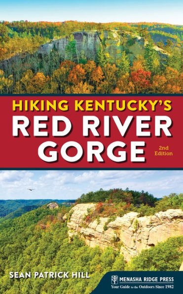
Hiking Kentucky's Red River Gorge
eBook
Available on Compatible NOOK devices, the free NOOK App and in My Digital Library.
Related collections and offers
Overview
Hike and Backpack in Nature’s Stunning Beauty
The rugged wilderness of Kentucky’s Red River Gorge is like no other. Dense forests, wondrous rock formations, and awe-inspiring views make it a paradise that’s waiting to be explored. Whether you’re a beginner or an experienced hiker, you’ll find carefully maintained trails that are perfect for your needs. Hiking Kentucky's Red River Gorge is the definitive guide to the Red River Gorge Geologic Area, Natural Bridge State Park, and Clifty Wilderness. This updated, full-color edition by Kentucky author Sean Patrick Hill showcases 25 of the best hikes in the Gorge, as well as a selection of recommended nearby trails.
The book’s easy-to-use layout treats each hike as its own adventure, presenting trail details, maps, full-color photographs, and tips for enjoying the flora, fauna, and history along the way. Ratings for key elements that make each trail appealing help you to quickly make an informed decision about which hike to choose for yourself or the whole family. Thrill-seekers will also discover how to combine routes into a longer adventure for a full day of hiking or even a backpacking trip. It’s everything you need to know to experience the famed Red River Gorge on foot.

Product Details
| ISBN-13: | 9781634041386 |
|---|---|
| Publisher: | Menasha Ridge Press |
| Publication date: | 11/26/2019 |
| Sold by: | Barnes & Noble |
| Format: | eBook |
| File size: | 28 MB |
| Note: | This product may take a few minutes to download. |
About the Author
Sean Patrick Hill is a writer, poet, and photographer living in Louisville, Kentucky. He has written for Sierra Magazine, The Oregonian, Kentucky Monthly, LEO Weekly, and Louisville Magazine. His photography has appeared in numerous publications, including the journal Phoebe. Aside from the Red River Gorge, he hikes Pine Mountain, Cumberland Gap National Park, and the Knobs region in Kentucky, and he has walked and backpacked throughout the country.
Read an Excerpt
Pilot Knob
- Scenery: 3
- Trail Condition: 3
- Children: 3
- Difficulty: 3
- Solitude: 4
- GPS Trailhead Coordinates: Pilot Knob Trailhead N 37˚ 54.723' W 83˚ 56.697'
- Distance&Configuration: 4.5-mile loop
- Highlights: Wooded terrain and a view over the Cumberland Plateau
- Hiking Time: 3.0 hours
- Elevation: 800 feet at the trailhead, with 1,240 elevation gain
- Access: Open 24/7; vehicle pass required for overnight parking
- Maps: USGS Levee; trail map available on KSNPC website
- Facilities: None
- Wheelchair Access: None
- Comments: Dangerous cliffs are present and should be avoided, especially by children.
- Contacts: Kentucky State Nature Preserves Commission, (502) 782-7839; http://naturepreserves.ky.gov/naturepreserves/Pages/pilotknob.aspx
Overview
Just off the Mountain Parkway west of the Red River Gorge lies the 742-acre Pilot Knob State Nature Preserve. Pieced together beginning with an original purchase made with The Nature Conservancy, it covers creek bottoms, wooded ridges and the highlight, a 730-foot-high sandstone outcrop that is said to have been visited by Daniel Boone, which looks out over both the Bluegrass region and the beginning of the Cumberland Plateau. Though one can take a fairly steep incline straight to the top, it’s worth it to tour the entire area, rich in wildflowers and native Kentucky hardwoods.
Route Details
From the parking lot, set out east on the trail, crossing Brush Creek. In 0.2 mile, you’ll reach the first junction; to the right is the 0.4-mile loop of the Millstone Quarry Trail, worth an exploration. To the left is the Oscar Geralds, Jr. Trail, which charges upward in just under a mile to the peak of Pilot Knob; to do so, simply continue upwards, staying left at both junctions of the Sage Point Trail.
While this is a decent hike, though short, it’s more challenging—and ultimately more fulfilling—to do the entire loop of the area. To do so, go right at the first junction with the Sage Point Trail. From here, you’ll amble along ridgelines thick with oak and hickory, dropping down to another creek and wild-flowered bottomlands (sometimes crossing powerline roads), and climbing again toward the prominence of Pilot Knob. After the two miles of the Sage Point Trail, watch for the trail to the right; follow this 0.4 mile to some stunning rock formations and, finally, the cliff-edge view that, in spring, flowers with mountain azalea.
To return, follow this trail back 0.4 mile, then turn right for 0.3 mile on the Geralds Trail. As you descend, watch upward to the right for the cliff you were just on. Keep right at the junction with the Sage Point Trail, and again keep right after another 0.3 mile at the junction with the Millstone Quarry Trail. Return the last quarter-mile to your car.
Directions
From Exit 16 off the Bert T. Combs Mountain Parkway, go right on KY 15 for 2.9 miles, and then turn right on Brush Creek Road for 1.6 miles to the parking area at the end of the road. The trail begins at the edge of the lot.
Table of Contents
- Angel Windows
- Chimney Top Rock, Princess Arch, and Half Moon Arch
- Courthouse Rock and Auxier Ridge
- D. Boon Hut
- Double Arch
- Grays Arch
- Koomer Ridge and Hidden Arch
- Pinch-Em-Tight Ridge
- Rock Bridge Arch
- The Rough Trail
- Sheltowee Trace
- Silvermine Arch and the Cliff Trail
- Sky Bridge
- Whistling Arch
- Whittleton Arch
Clifty Wilderness
- Sheltowee Trace–Bison Way Loop
- Sheltowee Trace–Osborne Bend Loop
- Swift Camp Creek Trail
- Swift Camp Creek–Wildcat Loop
- Tower Rock
- Turtle Back Arch
Natural Bridge State Resort Park
- Balanced Rock and the Rock Garden Trail
- Henson’s Cave Arch
- Hood’s Branch–Sand Gap Loop
- The Original Trail
New Hikes
- Pilot Knob State Nature Preserve
- Powder Mill Trail
- Whites Branch Arch
Appendixes and Index
- Appendix A: Outdoor Retailers
- Appendix B: Hiking Clubs
- Appendix C: State and Federal Agencies
- Index
About the Author