


eBook
Available on Compatible NOOK devices, the free NOOK App and in My Digital Library.
Related collections and offers
Overview

Product Details
| ISBN-13: | 9781491810385 |
|---|---|
| Publisher: | AuthorHouse |
| Publication date: | 09/13/2013 |
| Sold by: | Barnes & Noble |
| Format: | eBook |
| Pages: | 88 |
| File size: | 44 MB |
| Note: | This product may take a few minutes to download. |
Read an Excerpt
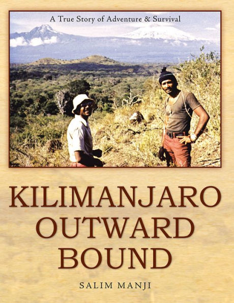
KILIMANJARO OUTWARD BOUND
A True Story of Adventure & Survival
By SALIM MANJI
AuthorHouse
Copyright © 2013 Salim ManjiAll rights reserved.
ISBN: 978-1-4918-1037-8
CHAPTER 1
OUTWARD BOUND.
It was nearing the end of October in 1973 when I received the best mail I could have hoped for. It was a letter from the Canadian High Commission in Dar-es-Salaam. My Canadian Visa had arrived! This was my ticket out of Tanzania for good. I was almost twenty-one years old, and this, I thought, was the best day of my life. Yet before I would cross the ocean, I had another mountain to climb – a literal one – that would prove to give me some of the best memories of Africa to carry with me to my new home.
My name is Salim. I was born in the town of Iringa, Tanzania on the 3rd of November 1952. It was there that I finished my primary school education at H.H. the Aga Khan primary school. I continued my secondary education in Mbeya in the southern highlands of Tanzania, at an institution called Iyunga Secondary School (Boarding). At Iyunga, I was offered the chance to go to the Outward Bound School, a physically challenging program teaching tenacity, confidence, and perseverance in harsh conditions. Apart from the challenging teachings of the school, the fact that students would climb Mount Kilimanjaro thrilled me. Unfortunately, at that time I failed the medical exam, which was mandatory for enrolling in the Outward Bound School. Signs of bronchitis kept me from that trip of a lifetime.
It was the end of 1973 and my Canadian Visa would expire in less than a year. I knew I had to climb Mt Kilimanjaro before I left Tanzania or I would never touch the snows of Mt Kilimanjaro. My impending departure limited my chances. So, I convinced my friends to participate in a crazy adventure. The year 1974 presented few restrictions when it came to climbing, and as a born Tanzanian fluent in Kiswahili, I could have gone to Arusha or Moshi and arranged the trip myself. However, not only was this trip my idea, but I was also the oldest, and felt responsible for the welfare of my friends, so instead I began correspondence with The Outward Bound Mountain School.
Outward Bound was (and is) a school aiming to foster personal growth and awareness, as well as social skills, through challenging outdoor expeditions. Founded in Wales in 1941 by Kurt Hahn, it is now an international organization with schools all over the world and thousands of students of all ages and races. Through courses ranging from one week to four weeks in length, it develops confidence and leadership in young people. It offers companies team building strategies and enables "at-risk" children and youth opportunities to better understand themselves and others.
During the course, students are usually divided into small groups known as 'patrols' or 'watches' under the guidance of one or more instructors. Typically, these patrols spend the first few days of the course in various forms of training, for the activities the course will entail. Different Schools offer different challenges such as backpacking, hiking, desert backpacking, canyoneering, dog sledding, canoeing, rafting, and sailing, all the while learning the philosophy of Outward Bound: a form of compassionate self-reliance combined with care for others. With the Motto of, "To serve, to strive, and not to yield"
As with all risky and dangerous activities, Outward Bound schools have had their share of accidents. In Oregon, two young girls died of exposure. In US alone, over 24 deaths have occurred including three instructors. In New Zealand, an individual died while crossing a river. In Africa, a student fell to his death from a ropes course. Two students in Germany died in an avalanche, and in Australia, up to six had drowned. Other reports include a student and an instructor losing their lives in South Africa and a Canadian student perishing on a solo expedition. No wilderness adventure is without its risk. This is perhaps one of the inherent draws of a wilderness adventure – the thrill of facing dangers and facing one's fears, in the hopes of finding strength and overcoming challenges.
The Outward Bound Mountain School of East Africa, developed in 1955, is situated in Kenya, in the district of Loitokitok, near the Tanzanian border and on the edge of the northern rainforest of Kilimanjaro. With a panoramic view of the Masai Game Reserve and the Chyulu Hills, it is one of the most beautiful places in East Africa. The school nestles in the woodlands, spanning 30 acres at an elevation of 5855 feet above sea level. It includes a swimming pool and paths that lead to camp sites, steeple chase routes, caves for exploration, and activities such as rock climbing, high ropes and gorge jumping to exhilarate students. There is no running water, most certainly no hot water, and the only outward communication is by ham radio. In 1973, five hundred Kenya shillings covered boarding, lodging and rental of equipment for one month for each person. Our travel from Iringa to Nairobi cost extra. The expense offered an extra challenge, but we overcame that challenge with the knowledge and anticipation that the adventure would be priceless.
Since its development in 1955, East Africa Outward Bound Mountain School, has been arranging trips to Mount Kilimanjaro. In 1973 as we prepared for our own expedition, it offered the necessary equipment, training, and helpful instruction for a safer adventure and the protection I wanted to offer my friends who would brave the climb with me.
Our little climbing group started as six. Iringa is a small town and word of our adventure spread fast. Some of my friends' parents opposed the idea, calling it a worthless and dangerous mission. Zahir, being only fifteen years old, was forbidden by his parents and grandfather. Moez had to cancel due to family commitments, and with that, our group was down to four. We, who remained, included, Shafik, Nadir, and the other Salim, who joined when his brother learned about our journey and encouraged Salim to join us. Salim, in fact, was the only one whose family did not oppose this dangerous and exciting climb.
January was our month. We would start 1974 with a bang. We decided if we were going to cross the border, we might as well go all the way to Nairobi. So we travelled from Iringa by bus to the town of Arusha. After a two-day stay, we headed to Moshi, where Nadir discovered he had left his passport behind! We hoped that we might be able to explain and pass through the border, as the school was only 50 miles from there, but in the end decided to cross with some locals who could come and go freely through the area. With their help and direction, we finally reached the school. We were the first to arrive, and the rest of the group followed two hours behind us.
CHAPTER 2
KILIMANJARO
Africa was once known as the Dark Continent, a mysterious place teeming with deadly diseases and dangerous wild animals. It boasted the Black Mamba, the spitting cobras, and the Big Five: lion, leopard, rhino, elephant, and Cape buffalo. It swarmed with venomous insects: mosquitos' silently spread malaria, fire ants, spiders and scorpions all around. The land itself was precarious and temperatures could reach scorching levels.
When the first westerner "discovered" Kilimanjaro in 1848, scientists could not believe that a mountain with an ice cap could exist so close to the Equator. It took them many years to confirm this. Africans, however, had always been aware of Kilimanjaro and its ways, all respecting and some even worshipping the great mountain.
So how did this great peak of Africa come to be? Millions of years ago, on the Eastern side of Africa, an enormous event had started to take place; a construction of nature. The Earth's weakened crust began tearing Africa apart and sinking, forming great volcanic mountains and lakes in the process. I am sure that when Kibo (one of the three volcanic cones of Kilimanjaro) erupted, the entire continent of Africa trembled, and the shock waves must have traveled around the globe half a dozen times. Today this area, the longest fault system in the world is known as the Great Rift Valley. Here, Kilimanjaro was born.
The Great Rift Valley.
At its broadest point, The Great Rift Valley stretches one hundred kilometers from one end to another and at the narrowest point, which is in Kenya, it reaches approximately forty-five kilometers. It runs from Syria to Mozambique, a staggering six thousand kilometers in length, and ranges from around 1300 feet below sea level at the Dead Sea to over 6000 feet above sea level in other areas. The East African rift is divided into the Western and the eastern rift. It includes several active and semi-active volcanoes, as well as abundant hot spots and boiling springs. It hosts about thirty lakes, many with different compositions. The Great Rift Lakes of Africa are habitat to diverse fish and bird-life. The surrounding areas are home to many exotic animals. The Rift Valley of East Africa has been a rich source of fossil and bone findings of several hominids. It appears our ancestors roamed here. The Olduvai Gorge, a steep-sided ravine located in the Serengeti in Tanzania, is considered to be the 'cradle' of humanity, providing scientists with extensive knowledge of early human evolution, and is one of the most important prehistoric sites in the world.
The following is information about a few of the lakes and mountains located in Kenya and Tanzania, within the Rift Valley.
The African Great Lakes
Lake Victoria
Lake Victoria, the size of Ireland at 26563 square miles, is the largest lake in Africa, the largest tropical lake in the world, and the source of the river Nile, but it is not in the Rift Valley. It is actually located in a depression between the eastern and western rifts, 3719 feet above sea level.
Lake Tanganyika
This is the largest of the Rift Valley lakes, 12702 sq miles. It has the longest fresh water and the second deepest lake in the world, second only to Lake Baikal in Siberia. It is 2515 feet above sea level and the bottom is 2195 feet below sea level.
Lake Malawi (Nyasa)
Overall the third largest lake in Africa, and the eighth largest lake in the world, this is the second largest lake in the Rift Valley region. A warm water lake, the average temperature is about 26 degrees Celsius year round. A fresh water lake, its elevation is 1640 feet above sea level, its widest point is 75 kilometers, and is 11600 square miles.
The Mountains
Mount Kenya
Located in central Kenya, this is the highest mountain in the country and the second highest mountain in Africa at an elevation of 17058 feet. It is the land of the Kikuyu, Masai, Ameru, and Embu tribes, some of whom believe that God resides on Mount Kenya. As such, they build their homes with the doors facing the mountain. Scientists believe that in its prime, Mount Kenya was even higher then Mount Kilimanjaro and looked similar to Mount Fuji in Japan.
Mount Elgon
This second highest mountain in Kenya, an extinct shield volcano, borders Uganda. Mount Elgon exhibits one of the largest intact calderas in the world. It is also home to the dangerous Kitum Cave. At Mount Elgon, one of the only natural sources of salt is found deep within the side of the mountain, and elephants enter caves such as Kitum to find salt in the rock, causing instability within the caves. Bats and dangerous wildlife such as leopards and hyenas also live in the cave, and two lethal cases of Marburg Virus, related to Ebola virus and causing extensive hemorrhaging within the body, are recorded as originating here.
Mount OlDoinyoLengai (Mt Lengai)
Named in Masai for Mountain of God, this active volcano towers high in Northern Tanzania. A unique feature of this volcano is its lava composition. Due to its unusual composition, the lava erupts at relatively low temperatures. In fact, the temperature is so low that the molten lava appears black in sunlight, rather than glowing red.
Mount Meru
Mount Meru, only 43 miles from Mount Kilimanjaro and the second highest peak in Tanzania at 14980 feet, is referred to as Mount Kilimanjaro's little sister and is a large active stratovolcono that lost its ice cap in the 1960s.
Ngorongoro Crater
When a giant volcano, thought to have rivaled Mount Kilimanjaro, exploded and collapsed on itself millions of years ago, it created the Ngorongoro Crater, 102 square miles. Today, this crater is the largest un-flooded and unbroken caldera in the world and it hosts more than thirty thousand animals, making it one of the most densely crowded wildlife areas in the world. Africa's Garden of Eden, it is often referred to as the eighth wonder of the world.
Mount Kilimanjaro - The King of the African Mountains
Located in north-eastern Tanzania at the border of Tanzania and Kenya, 50 miles from the Rift Valley, towers the giant stratovolcano dormant not extinct volcano Mount Kilimanjaro, highest free-standing Mountain in the world. Scientists claim that no other mountain in the world exceeds its mass. It is so heavy that it depresses the earth's very crust. Six different ecological zones exist within its vicinity, ranging from wet rainforest – one of the wettest in the world – to dry alpine desert, to arctic at its uppermost reaches. Varying climate creates diverse vegetation; here live shrubs, plants and flowers thus far found nowhere else in the world. It is said, on a clear day one can see Mt Kilimanjaro from over a hundred miles away; from its summit a climber can see the Indian Ocean. Mount Kilimanjaro is composed of three distinct volcano cones: Kibo, Mawenzie at 16,890ft and Shira at 13,000ft. The 4th highest of, "The seven summits" is Kibo; with a 30 mile base, 15 miles wide, and covers an area of approximately 460 sq. miles. It is close to 4 miles high and its perfect-circle crater is one and half miles across. On Kibo, Uhuru peak is the highest point; it is on the southern rim of the outer crater, close to 20,000ft.
Although Kilimanjaro is inactive, it has fumaroles that emit gas in the crater on the main summit of Kibo, causing several collapses and landslides; its last volcanic activity was some 200 years ago. Shira has eroded so much since its birth that some consider it to be a plateau.
A television documentary titled 'The Twenty-Five Most Dangerous Places in the World' ranked Kilimanjaro nineteenth on its list. On average, Kilimanjaro claims ten lives each year, not including porters. Though climbing, or rather hiking, the mountain requires no special training, the danger is high altitude thin air. Many deaths can be attributed to improper acclimatization, causing altitude sickness, also known as Acute Mountain Sickness. Hypothermia and sudden changes in weather also take lives. More climbers attempt Mount Kilimanjaro than Mount Everest, and more climbers perish there also.
Here are some fascinating facts about several climbs of Kilimanjaro:
• The first known climb occurred in 1889 and took 6 weeks.
• In 2009, eight blind climbers scaled Kilimanjaro. The climb has also been completed by an individual in a wheel chair.
• The fastest ascent time was by an individual from Italy, who hiked from Marangu Gate to Uhuru Peak in under six hours in 2001. In 2004, a local guide ran up and down the mountain in under nine hours.
• The youngest child to reach the peak has been seven years old, with documented cases of ages ten and twelve reaching the top.
• On January 1, 2000, over 1000 hikers reached the summit, out of 7000 who attempted.
In the last one hundred years, Mount Kilimanjaro has lost an estimated 80% of its ice cap. It is predicted that the mountain could become ice-free by 2020 if current climatic trends do not change.
CHAPTER 3
IRINGA
My mother's grandfather landed in Bagamoyo in 1894 when he was 12 years old. Bagamoyo was a small but important trading port in Tanzania (Tanganyika at the time) that traded in salt, ivory, copra, fish, and at one time was a slave trading center. Bagamoyo teemed with Arab and Indian traders as well as other explorers from around the world on sponsored and financed expeditions: Richard Burton, Henry M. Stanley ('Dr. Livingstone I presume?') And John H. Speke, to name a few. They came to look for the source of the River Nile, traveling with their guides, porters, slaves and servants.
When he was a young boy, my great-grandfather came as an immigrant and entrepreneur in search of a better life. He came with nothing but a small carry-on bag of belongings. Along with him, other immigrants came to settle in Bagamoyo and other places such as Zanzibar and Dar es Salaam. My great-grandfather however, did not want to settle just yet. When he learned about a caravan of traders going into the interior of Tanganyika, he took a chance and journeyed along with them as they ventured out into the dense jungle.
After over a month of travelling, they reached the town of Iringa. Iringa was dominated by the Hehe tribe. Iringa is in fact, their word for 'fort'. In the late 1800s, Chief Mkwawa of the Hehe tribe lived in Kalenga, a short distance from Iringa, in a hilltop fortress overlooking the Great Ruaha River, at an altitude of 5000 feet above sea level. When the Germans came to conquer the area, Mkwawa, a powerful chief and an expert in guerilla warfare, kept up resistance for seven years, despite the Germans' superior weaponry, using only spears and a few guns that he had acquired fighting them. Finally trapped, he would not allow himself to be taken alive. Instead, he shot himself on July 19, 1898. The Germans celebrated their victory by cutting off the head of Chief Mkwawa, which they sent for display to a museum in Berlin. It was not until 1954 that the skull of the mighty chief was returned, and it is now on display at the Mkwawa Memorial Museum in Kalenga. Another interesting site only 12 miles southwest of Iringa is Isimila Stone Age site; stone tools and archeological artifacts have been found dating back almost 70,000 years.
(Continues...)
Excerpted from KILIMANJARO OUTWARD BOUND by SALIM MANJI. Copyright © 2013 Salim Manji. Excerpted by permission of AuthorHouse.
All rights reserved. No part of this excerpt may be reproduced or reprinted without permission in writing from the publisher.
Excerpts are provided by Dial-A-Book Inc. solely for the personal use of visitors to this web site.
Table of Contents
Contents
CHAPTER ONE ... OUTWARD BOUND.................... 1
CHAPTER TWO ... KILIMANJARO.................... 5
CHAPTER THREE ... IRINGA.................... 11
CHAPTER FOUR ... THE SCHOOL.................... 15
CHAPTER FIVE ... SOLO the first Expedition.................... 21
CHAPTER SIX THE 2ND ... EXPEDITION.................... 37
CHAPTER SEVEN ... THE LAST EXPEDITION.................... 59