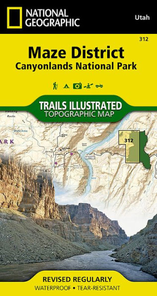
• Waterproof • Tear-Resistant • Topographic MapOf the four districts in Canyonlands National Park, the Maze District is the least accessible and requires planning and time to explore its remote landscapes. Expertly researched and created in partnership with local land management agencies, National Geographic's Trails Illustrated map of Maze District provides an unparalleled tool for exploring this extraordinary region. Key areas of interest featured on this map include Colorado and Green rivers; Cataract, Stillwater, and Horseshoe canyons; Land of Standing Rocks; Orange Cliffs; and a large portion of the adjacent Glen Canyon National Recreation Area.
The map base includes contour lines and elevations for summits. Trails and roads include mileage between intersections, and river mileage is noted as well for those exploring by boat. Road types are differentiated so you know if the route you choose is a four-wheel-drive or high-clearance road. Mountain bike routes are color-coded according to difficulty. Handy trail and backcountry road summaries, and helpful information about backcountry safety, regulations, and permits is included as well. Recreation features are clearly marked, including campgrounds, picnic areas, points of interest, boat launches, and scenic overlooks.
Every Trails Illustrated map is printed on "Backcountry Tough" waterproof, tear-resistant paper. A full UTM grid is printed on the map to aid with GPS navigation.
Other features found on this map include: Canyonlands National Park, Glen Canyon National Recreation Area, Green River, Soda Springs Basin.
- Map Scale = 1:35,000
- Sheet Size = 25.5" x 37.75"
- Folded Size = 4" x 7.5"