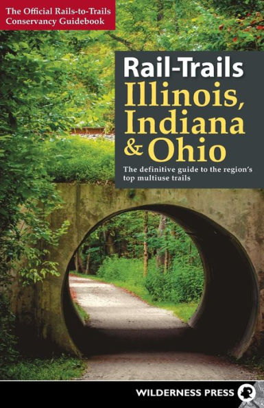
Rail-Trails Illinois, Indiana, & Ohio: The definitive guide to the region's top multiuse trails

Rail-Trails Illinois, Indiana, & Ohio: The definitive guide to the region's top multiuse trails

by Rails-to-Trails Conservancy
Rail-Trails Illinois, Indiana, & Ohio: The definitive guide to the region's top multiuse trails

Rail-Trails Illinois, Indiana, & Ohio: The definitive guide to the region's top multiuse trails

by Rails-to-Trails Conservancy

Paperback

$18.95 
  • SHIP THIS ITEM
    Qualifies for Free Shipping
  • PICK UP IN STORE
    Check Availability at Nearby Stores

Related collections and offers


Overview

Explore 72 of the best rail-trails and multiuse pathways across three states.

All across the country, unused railroad corridors have been converted to public multiuse trails. Here, the experts from Rails-to-Trails Conservancy present the best of these rail-trails, as well as other multiuse pathways in Illinois, Indiana, and Ohio. Tour Ohio’s Amish country, take a ride along Chicago’s lakefront, and enjoy the picturesque countryside on Indiana’s longest rail-trail. These adventures and more await you on the many multiuse trails of the Midwest!

In this book, you’ll find:

  • Detailed maps for every rail-trail, plus driving directions to trailheads
  • Icons indicating the activities each trail can accommodate
  • Succinct descriptions written by rail-trail experts
“You can now throw away all your self-help books on fighting depression, losing weight, toning muscles, finding something to do with your kids, and learning American history. Just use this guide, find a great trail—and enjoy!”
—Peter Harnik, Director, Center for City Park Excellence, Trust for Public Land

Product Details

ISBN-13: 9780899978482
Publisher: Wilderness Press
Publication date: 05/16/2017
Series: Rail-Trails
Pages: 272
Sales rank: 517,109
Product dimensions: 5.50(w) x 8.50(h) x (d)

About the Author

Rails-to-Trails Conservancy is a nationwide nonprofit dedicated to converting former railroad corridors to public, multiuse recreational trails that offer easy access to runners, hikers, bicyclists, skaters, wheelchair users, and equestrians. It serves as the national voice for more than 160,000 members and supporters, more than 23,000 miles of open rail-trails across the country, and more than 8,000 miles of potential trails waiting to be built—with a goal of ensuring a better future for America made possible by trails and the connections they inspire. To find out more about Rail-Trails, check out the Conservancy's official website at railstotrails.org.

Read an Excerpt

Lincoln Prairie Trail (Illinois)

  • County Christian
  • Endpoints IL 29 at County Road 12/E. 350 North Road (Pana) to S. Paw Paw St. and E. Market St. (Taylorville)
  • Mileage 14.6
  • Type Rail-Trail
  • Roughness Index 1
  • Surface Asphalt
  • Uses Cycling, in-line skating, fishing, wheelchair access, walking, cross-country skiing
While you’re in the land of Lincoln, visit the Lincoln Prairie Trail to make the trip complete. Starting at the trailhead in northwest Pana, leisurely stroll along a paved trail that is nicely separated from the rural highway. The route offers a fairly flat and straight shot to Taylorville with a combination of tree-canopied sections and more open areas.

The trail skirts several active silos via on-road routes as it passes through Millersville and Owaneco, but these short diversions are well marked and located on very lightly traveled small-town roads. The trail is well woven into the local communities and surrounded by the region’s many farms. Depending on the time of year, you can find corn, soybean, and sunflower fields for many miles.

One trail highlight is the stretch along Lake Taylorville and the South Fork Sangamon River on the north end of the route. At the time of this writing, the bridge over Flat Branch was closed; however, this closure doesn’t detract too much from the end-to-end experience. As you approach Taylorville, the development patterns become more suburban, and the trail ends unceremoniously at South Paw Paw Street.

DIRECTIONS
Parking can be found at the southeastern end of the trail in Pana. From I-70, take Exit 63 for US 51. Head north on US 51 for 29.6 miles. As US 51 N approaches Pana, it becomes Fair Ave. and then Poplar St. Near the center of town, Poplar St. intersects with Washington St.; turn left onto Washington, which is also IL 29. Follow Washington west and then northwest as the road curves 1.1 miles to E. 350 North Road; the trailhead parking lot is located on your left at this intersection.

On the other end of the trail, parking is available in Taylorville. Follow the directions above to IL 29/Washington St. Turn left onto IL 29, and go 15.4 miles. Just after passing IL 48 in Taylorville, turn left onto E. Main Cross St. Go 0.4 mile to S. Paw Paw St., and turn left; in about 280 feet you will see the trail and the unpaved parking area on your left.

CONTACT:
panaillinois.org/trail.htm

Table of Contents

About Ralls-to-Trails Conservancy iii

Foreword viii

Acknowledgments ix

Introduction 1

How to Use This Book 3

Illinois 6

1 Bloomingdale Trail (The 606) 8

2 Chicago Lakefront Trail 11

3 Constitution Trail 14

4 Des Plaines River Trail 18

5 Fox River Trail 21

6 Great River Trail 25

7 Great Western Trail 29

8 Hebron Trail 32

9 Illinois and Michigan Canal State Trail 35

10 Illinois Prairie Path 40

11 Interurban Trail 44

12 Jane Addams Trail 47

13 Lincoln Prairie Trail 50

14 Long Prairie Trail 53

15 Madison County Transit Ronald J. Foster Heritage Trail 56

16 Madison County Transit Schoolhouse Trail 59

17 Millennium Trail 62

18 North Branch Trail 65

19 Old Plank Road Trail 68

20 Prairie Trail 71

21 Robert McClory Bike Path 74

22 Rock Island Trail 78

23 Sam Vadalabene Great River Road Bike Trail 81

24 Tinley Creek Trail 85

25 Tunnel Hill State Trail 88

26 Virgil L. Gilman Trail 92

27 Wauponsee Glacial Trail 95

Indiana 98

28 Big 4 Rail Trail (Zionsville) 100

29 Cardinal Greenway 103

30 Delphi Historic Trails 107

31 Erie Lackawanna Trail 110

32 Indianapolis Cultural Trail 113

33 Monon Trail 116

34 Nickel Plate Trail 120

35 Oak Savannah Trail 123

36 Panhandle Pathway 126

37 Prairie Duneland Trail 129

38 Pumpkinvine Nature Trail 132

39 Rivergreenway 135

40 Sweetser Switch Trail 139

41 Vandalia Trail 142

Ohio 146

42 Alum Creek Greenway Trail 148

43 Bike and Hike Trail 151

44 Camp Chase Trail 154

45 Conotton Creek Trail 157

46 Creekside Trail 160

47 Great Miami River Trail 163

48 Heart of Ohio Trail 166

49 Hockhocking Adena Bikeway 169

50 Holmes County Trail 172

51 Kokosing Gap Trail 175

52 Little Miami Scenic Trail 178

53 MetroParks Bikeway 182

54 North Coast Inland Trail (Huron Comity) 185

55 North Coast Inland Trail (Lorain County) 188

56 North Coast Inland Trail (Sandusky and Ottawa Counties) 191

57 Ohio & Erie Canal Towpath Trail 194

58 Ohio to Erie Trail 198

59 Olentangy Trail 204

60 Prairie Grass Trail 207

61 Richland B&O Trail 210

62 Rocky River Reservation All Purpose Trail 213

63 Scioto Greenway Trail 216

64 Simon Kenton Trail 219

65 Sippo Valley Trail 223

66 Slippery Elm Trail 226

67 T.J. Evans Panhandle Trail 230

68 T.J. Evans Trail 233

69 Wabash Cannonball Trail 236

70 Western Reserve Greenway 240

71 Wolf Creek Trail 244

72 Xenia-Jamestown Connector 247

Index 250

Photo Credits 260

Support Rails-to-Trails Conservancy 261

From the B&N Reads Blog

Customer Reviews