Table of Contents
Preface ix
Acknowledgements xv
The First Images Of The World 1
Prehistoric maps, stories of creation, and Sumerian, Babylonian and Egyptian maps.
Like Frogs About A Pond 29
Ptolemy, one of the greatest geographers of his time, and the Greeks' increasing knowledge of the world throughout antiquity.
Holy Geography 63
A world made for humans by God, in which the clerics and cartographers of the Middle Ages depict the holy story of creation.
The First Atlas 95
Abraham Ortelius and Gerardus Mercator map the world's expansion as a result of the Europeans' numerous voyages and the Renaissance thirst for knowledge.
Venturing Out 135
A Norwegian map on the move, Dutch nautical charts, the battle for the biggest atlas, and more about Mercator and all he never managed to complete.
The Great Surveys 167
France, Denmark and Norway learn to survey large areas. Kongsvinger gets a prime meridian in 1779, and maps play a role in central government administration.
White Spaces In The North 209
The second Fram expedition sets out in 1898, in the wake of the many others that had previously tried to map the northern regions.
As Seen From Above 243
The First World War paves the way for aerial surveys, which in turn pave the way for a Norwegian economic map series and the appearance of maps in most. areas of society.
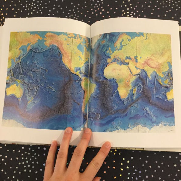
Blue Planet 271
About the seven tenths of our planet that are covered by water, and Marie Tharp's attempts to understand what the ocean floor looks like, and why.
The Digital World 305
Satellites and computers provide and manage vast amounts of information, and give us maps that are able to speak to us.
References 335
List Of Illustrations 349
Further Reading 351
Index 365